Visitor's guide | Photographing Lebanon's heritage, 1864 - 1970
Visitor's guide (english)
Photographing Lebanon's heritage, 1864-1970
Never-seen photographs from the Bibliothèque Orientale of Beirut
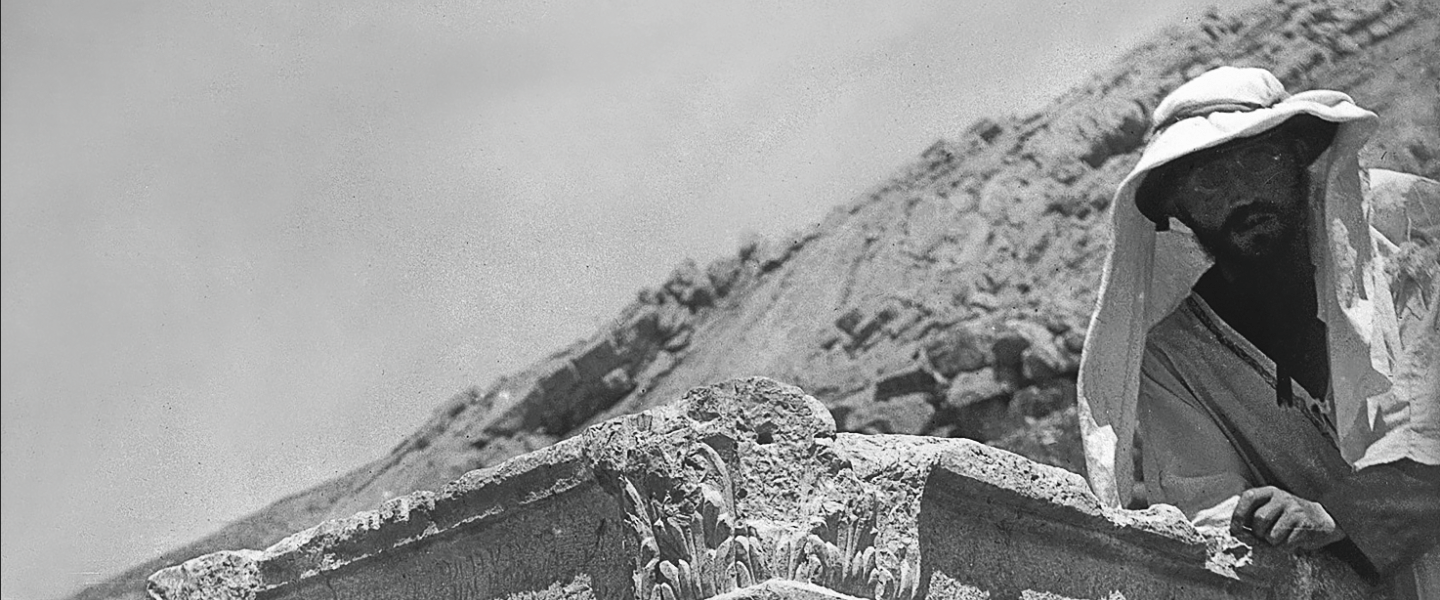
Founded in 1875, the Bibliothèque Orientale of Saint-Joseph University of Beirut (USJ) boasts a rich collection of photographs captured by generations of Jesuit fathers. The establishment of the Faculté orientale in 1902 provided an institutional framework for their research into the archaeology of Lebanon and neighboring countries. These scholars, whose theological and classical training predisposed them to the study of Greco-Roman antiquity, ancient languages and religions, were also pioneers in the study of Lebanese prehistory.
To illustrate the courses they taught and the articles they published in Mélanges de /'US} since 1906, the fathers roamed ail regions of Lebanon, taking tens of thousands of snapshots. The collection was later enriched with period photographs and more recent additions.
The Jesuit missionaries took a particular interest in photography and saw it as both an invaluable educational tool and a means of documentation, using it to disseminate their apostolic work. Their photographs reveal an ethnographie approach, as illustrated by the countless scenes of rural life and poignant portraits of tribes and communities. Sorne of the pictures, ta ken from the air, further reflect their pioneering work in aerial archaeology.
The Bibliothèque Orientale collection also bears witness to the history of photography in the Near East since its emergence in the 19th century, when Beirut rivaled Jerusalem and Constantinople as the region's major photography hub. lt encompasses a wide range of photographie techniques, from albumen prints to gelatin-bromide, and from glass plates of various sizes to flexible or paper supports.
The exhibition showcases photographs taken at sites such as Byblos, Baalbek, Tyre and Sidon, and in various regions, including Hermel, Beqaa, Shouf, Matn and Keserwan. lt features landscapes, monuments, and scenes of social and economic life.
The Bibliothèque Orientale photo collection is supported by the Boghossian Foundation, ALIPH, the Institut national du patrimoine (France) and the Archives nationales de France.
Photographs labels
Baalbek Panel
0. Baalbek - Quarry and Megalith - Stone of the Pregnant Woman, Hajar el-Hubla in Arabie, between 1860 and 1890
Tancrède Dumas Collection (1830-1905) Albumen print, 48x60 cm
Located in an ancient quarry near the Baalbek archaeological site, this monolith is one of the largest stone blacks ever carved by human hands in antiquity. The origin of its name remains uncertain, with several local legends attempting to explain it. The most plausible version credits it with the power to grant a child to any infertile woman who touches its surface.
This colossal monolith, weighing approximately 1,000 tons and intended for the Temple of Jupiter, was never moved. The reasons behind its abandonment remain a mystery. Excavations conducted by the Lebanese Directorate General of Antiquities in 2014 and 2019 uncovered even larger monoliths in the same quarry.
1. Baalbek - Heliopolis, City of the Sun - Temple known as Venus, circa 1958
Maurice Tallon SJ Collection (1906-1982) - Baryta print, 18x24 cm
Located about 200 meters outside the main sacred precinct of the Baalbek complex, the temple known as Venus was built in the 3rd century AD. lt stands out for its unique circular design and its elegant Corinthian columns. Early explorers of the site attributed it to Venus due to the presence of shell motifs in some niches, reminiscent of those traditionally associated with the goddess's birth. lts refined architecture stands in contrast with the monumental scale of other temples in the complex.
2. Baalbek - Heliopolis, City of the Sun - Temple known as the Temple of Bacchus, between 1860 and 1890
Tancrède Dumas Collection (1830-1905) Albumen print, 54x70 cm
Built during the 2nd century AD, the Temple of Bacchus, while not as grand as the Temple of Jupiter, is still one of the larges temples in the Roman world. The temple is dedicated to the divine triad of Baalbek, with the symbols of the three deities displayed on the lintel of the door. lts association with the god Bacchus is based on a depiction of a revelrous scene found on one of the altars lining the staircase leading to the innermost sanctum.
The temple may have also been used for a mystical and initiatory cuit, linked to local traditions. lt bears witness to the skili and sophistication of the architects of the Roman Empire.
This photograph shows the site before the major restoration campaigns of the 20th century.
3. Baalbek - Heliopolis, City of the Sun - Temple known as Bacchus, 1925
William Cruikshank Collection (1883-1950) - Baryta print, 13x18 cm
Providing a majestic entrance to the Temple of Bacchus, this monumental doorway of the cella, standing 13 meters high, is a testament to the monumental architecture of the Roman era. Richly adorned with floral and mythological motifs, it marks the transition between the secular and sacred worlds, reinforcing the solemnity of the site.
4. Baalbek - Heliopolis, City of the Sun - Temple of Jupiter, between 1930 and 1940
Henri Lammens SJ (1962-1937) and Gérard de Martimprey SJ (1873-1956) Collection Glass plate, 9x12 cm
Construction of the Temple of Jupiter began in the late 1st century BC, yet it was still unfinished four centuries later. This temple is considered the largest ever built in the Roman Empire. The photograph shows a vast courtyard surrounded by a portico that housed four semi-circular exedras and eight rectangular ones. ln the foreground, one can see one of the two ritual basins used for purification before sacrifices were made in honor of Jupiter Heliopolitan.
5. Baalbek - Heliopolis, City of the Sun - Triad of Temples, between 1950 and 1960
Manoug Alémian Collection (1918-1994) Baryta print, 18x24 cm
This view, taken from the southeast, reveals the location of the Baalbek temples in the Bekaa Valley, stretching all the way to the snow-capped peaks of Mount Lebanon.
6. Baalbek - Temple of Jupiter - 'ïhe Dance of Astarte," October 1922
Anonymous - Glass plate, 8x18 cm
Captured in the early years of the French Mandate (1920-1943), this photograph documents a performance of The Dance of Astarte, organized by mandate authorities. The piece, written by journalist Georges Vayssié, evokes ancient rituals associated with the goddess Astarte, the Roman Venus.
7. Hermel Pyramid, November 18, 1957
Maurice Tallon SJ Collection (1906-1982) Baryta print, 8.Sx10 cm
The Hermel Pyramid is a funerary monument built during the Hellenistic period (333-64 BC). lt consists of two stacked cubes topped by a pyramid, reaching a total height of 25 meters.
8. Baalbek-Hermel - Nymphaeum of Temnine, September 8, 1970
Maurice Tallon SJ Collection (1906-1982) - Paper print, 8.Sx10 cm
The Nymphaeum of Temnine el-Faouqa is located near Ain el-Jobb Spring. lt is vaulted with large stones and carved 4 meters deep into a hill. leading to an underground cistern. The nymphaeum was a key stop for pilgrims traveling to Baalbek during the Roman period.
ln 2024, the site received enhanced protection from UNESCO following lsraeli strikes in the region.
NIHA-ANJAR PANEL
O. Bekaa Valley - Wheat Winnowing, 1969
Varoujan Sétian Collection (1927-2003) Film negative, 6x6 cm
This photograph captures a scene of wheat winnowing in Anjar, at the heart of the Bekaa Valley.
Winnowing is a traditional practice that has shaped the agricultural identity and culture of Lebanon. The process of separating the grains from the chaff also highlights the originality of farmers in an environment influenced by elements such as wind and rain.
1. Hosn Niha Temple, 1864
Alexandre Bourquenoud SJ Collection (1824-1868) Albumen print, 18x24 cm
This view shows the eastern façade of the Hosn Niha Temple, a rare visual testimony from the 19th century and one of the earliest photographs in the collections of The Oriental Library.
This monument, dated to the late 2nd or early 3rd century AD, was constructed on a strategic site and presents architecture that illustrates the influence of local cuits during the Roman Empire.
ln 2024, the site received enhanced protection from UNESCO following lsraeli strikes in the region.
2. Great Temple of Niha - Propylaea and Structure, August 25, 1955
Maurice Tallon SJ Collection (1906-1982) - Baryta print, 8.5x10 cm
This view shows the propylaea (the monumental gateway) of the temple, with two of the three flights of stairs. Beyond the large door, decorated with linear motifs, the interior south wall and the southwest corner of the building stand out. The temple is dedicated to the god Hadaranes.
ln 2024, the site received enhanced protection from UNESCO following lsraeli strikes in the region.
3. Great Temple of Niha - Statue of the High Priest, August 25, 1955
Maurice Tallon Collection, SJ (1906-1982) - Baryta print, 8.Sx10 cm
A monumental altar stands in front of the staircase leading to the Great Temple, featuring a sculpted relief of a priest offering incense on a pyre (small altar). The inscription at his head tells us that his name was Narkisos and that he was a member of the Council of the Baalbek-Heliopolis colony. The inscription at his feet bears the sculptor's signature: ''Tiberis, priest, sculpted".
4. Hosn Niha Temple - Niche, 1926
René Mouterde SJ Collection (1880-1961) Glass plate, 9x12 cm
This photograph shows the monolithic niche structure, which bears an ex-voto inscription. Treasure hunters mistook it for a vault and blew it up with dynamite during the Lebanese Civil War (1975-1990).
A pillar from the monolithic structure, discovered in the nearby basilica, bears a Latin inscription referring to "the revenues from the lands mortgaged in honor of the god Mifsenus...".
5. Anjar - Umayyad Site, February 27, 1966
Maurice Tallon SJ Collection (1906-1982) Baryta print, 1Ox10 cm
Founded in the 8th century, the city of Anjar was an important center during the reign of the Umayyads (661- 750), showcasing the urbanism and culture of the first hereditary Muslim dynasty. The buildings reflect the reuse of architectural elements from Roman and Byzantine periods.
This photograph shows the Umayyad palace, the edge of Decumanus (the Roman road running from west to east), as well as the ruins of the mosque.
Listed as a UNESCO World Heritage site in 1984, the site received enhanced protection from UNESCO in 2024 following lsraeli strikes in the region.
6. Anjar - Umayyad Site, February 27, 1966
MauriceTallon SJ Collection (1906-1982) Baryta print, 10x10 cm
7. Bekaa Valley - Wheat Winnowing, 1969
Varoujan Sétian Collection (1927-2003) Film negative, 6x6 cm
BEQAA PANEL
0. Group of Bedouins, undated
The Imprimerie Catholique Collection (1852-1999) Glass plate, 18x24 cm
A group of Bedouins gathered under their tent. On the left, women are weaving carpet strips
1. Jeb Jennine - Roman Bridge, between 1960 and 1970
Maurice Tallon SJ Collection (1906-1982) - Baryta print, 8.5x10 cm
This photograph shows the northern façade of the Roman bridge, locally called el-Jisr el-Aatiq (the ancient bridge). Likely constructe in the early centuries AD, it is located near an ancient tell (mound) at the entrance to the village. Consisting of fourteen pillars, it once spanned the Litani River before its course was diverted. The bridge follows a Roman design, with elements added over the centuries, such as a flight of stairs that did not exist in Roman times.
2. Roman Temple of Ain Hirsha, circa 1950
Maurice Tallon SJ Collection (1906-1982) Baryta print, 10x10 cm
Lost among the rocks, this Roman temple is a distyle in antis structure of Ionie order, located in the region of Rachaya, below Mount Hermon to the south of the Bekaa Valley. lt is considered the best-preserved temple in the region. Shaken by an earthquake, it was reinforced in the 1930s. lts four walls still stand, along with its eastern entrance portal and rear pediment.
According to a Greek inscription discovered on a broken block in front of the pronaos, the temple was dedicated to an "ancestral god," and its sacrificial altar, now gone, was erected in 114-115 AD.
ln 2024, the site received enhanced protection from UNESCO following lsraeli strikes in the region.
3. Beaufort Castle (Qal'at al-Shaqif), February 18, 1955
Maurice Tallon SJ Collection (1906-1982) - Baryta print, 8.5x10 cm
Perched atop a cliff west of Marjeyoun, Beaufort Castle, also known as Qal'at al-Shaqif, was built by the Crusaders around 1137 and remained occupied until the Ottoman period.
lts strategic location offered its occupants not only a commanding view over much of southern Lebanon, but also a vantage point overlooking the northern region of the Holy Land.
4. Ferzol - Rock Carving of an Equestrian God, between 1910 and 1920
Sébastien Ronzevalle SJ Collection (1865-1937) - Glass plate, 13x18 cm
This rock carving is sculpted into one of the last exposed faces of the quarries high above Ferzol, standing out prominently in a square niche. lt depicts an equestrian god holding a globe and the reins of his horse, followed by a young god carrying a goat and fruits. ln the background, a date palm tree can be seen between the two figures.
BEITEDDINE-DEIR EL QAMAR PANEL
0. Beit Eddine - The Palace, 1924
Pierre de Vrégille SJ Collection (1875-1970) - Baryta print, 8.5x10 cm
Beit Eddine Palace was constructed by Emir Bashir Il Chehab in the early 19th century (between 1788 and 1818) to serve as the center of his power as Prince of Mount Lebanon. With its arcades, rooms decorated by Damascene artists, courtyards with fountains, and landscaped gardens, the palace offers a magnificent example of Lebanese architecture with ltalian influence.
After the fall of Emir Chehab in 1840, the palace became the headquarters of the Ottoman governor and later, during the French Mandate, the administrative palace. ln 1934, it was listed as a national historical monument.
Currently, the palace serves as the summer residence of the Lebanese presidency, but it also functions as a museum and hosts the annual Beit Eddine International Festival.
ln 2024, the site received enhanced protection from UNESCO following lsraeli strikes in the region.
1. Beit Eddine - The Palace - Dar el-Wusta, July 17, 1929
Pierre de Vrégille SJ Collection (1875-1970) - Baryta print, 8.5x10 cm
Another photograph of Dar el-Wusta shows the entrance to the salamlik, the area designated for receptions. Here, beautiful rooms on the ground floor are adorned with exquisite woodwork painted by Damascene artists.
2. Beit Eddine - The Palace - Dar el-Wusta, circa 1950
Maurice Tallon SJ Collection (1906-1982) -Baryta print, 8.5x10 cm
Beit Eddine Palace is composed of three major sections: the large courtyard (Maydan), the central part of the palace (Dar el-Wusta), and the gardens. Dar el-Wusta, depicted here, is built around a courtyard featuring a fountain. The interior of the building is designed for receptions, featuring elegant rooms decorated with marble and intricately carved and painted woodwork. This courtyard also leads to functional parts of the palace, such as the harem, the hammams, and the kitchens.
3. Deir el-Qamar, between 1906 and 1908
Joseph Goudard SJ (1873-1951) and Gérard de Martimprey SJ Collection (1873-1956) Glass plate, 13x18 cm
Deir el-Qamar, or 'The Monastery of the Moon," was the former capital of the Emirate of Mount Lebanon and the residence of the Maan Emirs for over a century, starting in the 16th century. The tow is filled with history of the emirs, with its monuments, palaces, fountains, cobbled streets and old houses. The village has been classified as a national historical monument since 1945.
This panoramic view of the village was taken from Beit Eddine.
KESROUAN-METN PANEL
0. Faraya - The Natural Bridge, circa 1930
Joseph Delore SJ Collection (1873-1944) Film negative, 8x14 cm
Jisr el-Hajar, or the "Stone Bridge," is a natural bridge located in Faraya (Keserwan District, Mount Lebanon), measuring over 38 meters in length. This remarkable geological phenomenon is the result of natural erosion of the rock over centuries. The "bridge" has become a symbolic site, attracting nature and geology enthusiasts.
1. Family Portrait, circa 1935
Joseph Delore SJ Collection (1873-1944)- Film negative, 8x14 cm
A portrait of a family from Ghazir, a town near Jounieh.
2. Weaving Workshops, circa 1905
The Imprimerie Catholique Collection (1852-1999) - Glass plate, 18x24 cm
ln addition to its archaeological heritage, the living artisanal heritage of Lebanon was also widely photographed by the Jesuit Fathers. ln this weaver's workshop, located in Zouk Mikael, a village north of Jounieh, a vertical loom shows the weaving of a striped fabric with contrasting hues.
3. Afqa - Sanctuary of Aphrodite Aphaktis or Venus of Aphaca, undated
Anonymous - Baryta print, 9x12 cm
The vast Afqa grotto, where the river of Nahr Ibrahim (Abraham River) flows, was known for its sanctuary dedicated to Aphrodite Aphaktis, goddess of fresh water sources. lt was destroyed in the 4th century by Emperor Constantine and later by an earthquake, leaving only a pile of rocks today.
The site remains a place of pilgrimage for both Christians and Muslims to this day, who tie pieces of fabric to the nearby great fig tree as ex-voto offerings, hoping to have a child, thus continuing an ancient fertility ritual.
ln 2024, the site received enhanced protection from UNESCO following lsraeli strikes in the region.
4. Nahr el-Kalb - The Bridge known as the "Arab Bridge", between 1950 and 1960
Manoug Alémian Collection (1918-1994) - Baryta print, 18x24 cm
The Nahr el-Kalb or "River of the Dog," formerly known as the Flumen Lycos or River of the Wolf, controlled access to the city of Beirut from the north.
The "Arab Bridge," originally constructed by the Mamluk Sultan Seifeddine Barqouq in the 14th century, was rebuilt several times. This photograph captures its state following its last restoration, carried out in 1809 under the reign of Emir Bashir Il Chehab; it bears witness to the 19th-century Ottoman architecture.
5. Stelae of Nahr el-Kalb, 1924
René Mouterde SJ Collection (1880-1961) Albumen print, 9x12 cm
Between the cliff and the sea, a narrow natural corridor acted as a strategic pass for armies heading towards the northern part of the country. Since Ramses Il, the Egyptian pharaoh of the 13th century BC, conquerors (Assyrians, Egyptians, Romans, Mamluks) have made sure to leave a record of their passage to commemorate significant events.
Not ail the stelae are legible, and the scenes depicted are almost entirely erased. The stelae built by Pharaoh Ramses Il was replaced in 1861 with an inscription in honor of Napoleon Ill.
This photograph shows two stelae: on the right, one depicts the Assyrian king Sennacherib standing in profile, raising his right hand and holding a scepter or mace in his other hand. On the left, the other stele shows the victorious Pharaoh Ramses Il holding a captive enemy while facing a bird-headed deity (Ra-Horakhty), with a hieroglyphic inscription that is greatly eroded today.
ln 2024, the site received enhanced protection from UNESCOfollowing lsraeli strikes in the region.
6. Jounieh Bay, between 1924 and 1925
Joseph Delore SJ Collection (1873-1944) 3 Film negatives, 8x14 cm
This panoramic view presents the bay, with its coastal municipalities, including Jounieh, known for its seaside restaurants and vibrant nightlife, and those situated higher up (Ghazir, Kfarhbab, Chnaniir, Ghosta), leading to Harissa, home to the sanctuary of Our Lady of Lebanon, with the statue of Virgin Mary overlooking the coastline.
7. Jounieh Bay, between 1910 and 1920
The Imprimerie Catholique Collection (1852-1999) Glass plate, 18x24 cm
Here, fishermen are pulling their nets on a beach in the bay.
8. Monks of the Antonine Maronite Order, 1902
Antoun Abdallah SJ Collection (1853-1923) Glass plate, 18x24 cm
A group of monks from the Antonine Maronite Order standing in front of the Monastery of St. John the Baptist in Deir al-Qalaa, Beit Mery.
9. Bell making Hub at Beit Chabab, circa 1905
The Imprimerie Catholique Collection (1852-1999) Glass plate, 18x24 cm
Beit Chabab is a village in Mount Lebanon that has preserved its traditional character and craftsmanship throughout the centuries. lt is renowned for its pottery, weaving, and bell making a craft introduced by the Russians in the 18th century. Beit Chabab is home to Lebanon's only bell foundry, which continues to produce bells for local churches and monasteries, as well as for those in neighboring countries.
10. Beit Mery - Deir al-Qalaa, 1902
Antoun Abdallah SJ Collection (1853-1923) Glass plate, 18x24 cm
Deir al-Qalaa, meaning "The Monastery of the Fortress," is the ancient site of Magoras, a significant Romano-Byzantine archaeological landmark in Beit Mery, a modern town in Mount Lebanon which overlooks Beirut.
The great temple, dating back to the Roman era (late 1st century AD) was dedicated to Baal Marqod, the Phoenician god of thunder, lightning, and earthquakes. Measuring 17 x 36 meters, it featured a monumental façade facing Beirut, with a portico adorned with four Ionie columns, characteristic of Roman architecture, giving the temple both elegance and splendor. These columns supported a structure that led to the sanctuary's interior.
Around 1748, the Antonine Maronite Order acquired the site and built a church dedicated to St. John the Baptist on the temple's ruins.
11. Beit Mery, Deir al-Qalaa, 1902
Antoun Abdallah SJ Collection (1853-1923) Glass plate, 18x24 cm
The site of Deir al-Qalaa consists of a grand sanctuary and a village that was once part of the Roman colony of Béryte (Beirut). The ruins are divided into three main sections: the great temple of Jupiter Balmarcod, a smaller temple dedicated to Juno to the north, and the ancient settlement to the northeast, which contained bathhouses, a proto-Byzantine church, and various artisanal workshops.
The Jesuit priest Sébastien Ronzevalle was the first to undertake excavations at Deir al-Qalaa in the summer of 1900. His unpublished archives, now preserved at The Oriental Library, are particularly valuable as the site suffered significant damage during the 20th century.
AKKAR PANEL
0. Aandqet, March 18, 1959
Maurice Tallon SJ Collection (1906-1982) Paper print, 8.Sx10 cm
A panoramic view of the village of Aandqet, located south of Mount Akroum.
1. Extended Tomb from the Necropolis of Qana Maabour, south of the modern village of Menjez, 1961
Maurice Tallon SJ Collection (1906-1982) Film negative, 2.4x3.6 cm
The megalithic tombs of Menjez, located in Akkar region in northern Lebanon, were discovered in the 1940s by Jesuit fathers, including Maurice Talion. They form one of the largest prehistoric necropolises in the country. These structures feature chambers with varied layouts, such as circular, quadrangular, or rectangular, constructed with either rough or worked basait blacks. The site was enhanced between 2017 and 2019, and archaeological excavations have been ongoing since 2022 under the supervision of the Lebanese Directorate General of Antiquities.
2. Tomb from the Necropolis of Watta, north of the modern village of Menjez, 1961
Maurice Tallon SJ Collection (1906-1982) - Film negative, 2.4x3.6 cm
3. Extended Tomb from the Necropolis of Qana Maabour, south of the modern village of Menjez, 1961
Maurice Tallon SJ Collection (1906-1982) Film negative, 2.4x3.6 cm
4. Akroum-Akkar, May 19, 1968
Maurice Tallon SJ Collection (1906-1982) Baryta print, 8.Sx10 cm
The site known as 'EI-Hassin Fortress,' located in Mount Akroum (Akkar region, northern Lebanon), consists of the remains of two Roman temples. These ruins cover an area of 2,000 square meters and are now shaded by ancient oak trees. Despite the site's difficult access, antiquities looters have managed to reach the temple, stealing column capitals that are now scattered across the area. The two temples of different sizes remain standing, though their roofs have been lost.
Nearby, Roman-era cisterns and water channels are still visible..
BEYROUTH PANEL
0. Beirut - The Imprimerie Catholique, 1925
The Imprimerie Catholique Collection {1852-1999) Glass plate, 18x24 cm
This photograph was taken in the press room, capturing employees of the Imprimerie Catholique in action. The printing press was founded by the Jesuit Fathers in 1852.
1. Beirut, 1931
The Imprimerie Catholique Collection (1852-1999) Glass plate, 1Ox15 cm
A panoramic view of Beirut with snow-covered Mount Sannine in the background.
2. Port of Beirut, 1906
Pierre de Vrégille SJ Collection (1875-1970) Baryta print, 6x9 cm
The Port of Beirut was the powerhouse of Lebanon in the 19th century, facilitating unprecedented urban development thanks to the thriving commercial activity.
On August 4, 2020, a devastating explosion rocked the port, causing widespread damage to the city, killing hundreds, and injuring nearly 4,000 people.
3. Beirut - Aerial View, 1936
Antoine Poidebard SJ Collection (1878-1955) Glass plate, 13x18 cm
This aerial view of Beirut and its coastline was taken from the east by Jesuit Father Antoine Poidebard, a pioneer in aerial archaeology in the Middle East and the author of around 20,000 photographs preserved in The Oriental Library. ln the foreground, the Armenian quarter of Bourj Hammoud stands out.
4. Beirut - School of Engineering at Saint Joseph University, circa 1923
The Imprimerie Catholique Collection (1852-1999) - Glass plate, 1Ox15 cm
Students pose in front of the Spad XIII, a French single-seat fighter aircraft from World War 1,in the courtyard of the School of Engineering at Saint Joseph University, founded in 1913.
5. Beirut - French Naval Fleet, April 15, 1927
Antoine Poidebard SJ Collection (1878-1955) Baryta print, 18x24 cm
The French naval fleet is anchored in the port of Beirut.
6. Beirut - The Pigeon Grotto or Raouche Rock
Joseph Delore SJ Collection (1873-1944) Film negative, 8x14 cm
7. Port of Beirut - Arrivai of the Train, circa 1908
Pierre de Vrégille SJ Collection (1875-1970) Baryta print, 6x9 cm
The Damascus-Beirut railway line was inaugurated on August 3, 1895. The first line operated under the Ottoman Empire, as part of a French concession granted in 1891. lt connected Beirut to Damascus via the city of Rayak, where a station, forge, and large factories were built. Beirut provided Syria with access to the sea, countering the British plan to connect Damascus to Jaffa in Palestine. Lebanon had three railway lines: Beirut-Damascus; Beirut-Haifa; and Beirut-Tripoli, with the latter two completed in 1942.
FILM PANEL
0. Antelias Cave, undated
The Imprimerie Catholique Collection Glass plate, 18x24 cm
The prehistoric Antelias Cave was excavated in 1900 by Father Godefroy Zumoffen (1848-1928), who is considered the pioneer of Lebanese prehistory. This cave was destroyed by dynamite in 1968 to become a quarry.
TRIPOLI PANEL
0. Tripoli - Khan el-Khayyatine ("Tailors' Market"), circa 1940
Jean Lauffray SJ Collection (1909-2000) - Film negative, 6x6 cm
Khan el-Khayyatine is one of the most famous historical souks in Tripoli. Built in 1341, it specialized in the sale of fabrics and garments, which attracted many tailors and artisans to the city.
The souk consists of a long alley covered with stone-built shops and rooms above, where artisans could both work and live.
1. Tripoli - Aerial View, 27 October 1936
Antoine Poidebard SJ Collection (1878-1955) Film negative, 13x18 cm
This aerial view of Tripoli and its port shows the submerged pier resting on reefs, which seems to have been carved to serve as a quay. The site demonstrates the originality in the development of Tripoli's port, reinforcing its strategic role.
2. Qannoubine - The Holy Valley of Qadicha, 1968
Varoujan Sétian Collection (1927-2003) - Film negative, 9x12 cm
The Holy Valley of Qadicha, located in the mountains of Northern Lebanon, is a sacred site for Maronite Christians, with monasteries and caves dating back to the early centuries of Christianity. These caves served as a shelter for the inhabitants of surrounding villages. A place of life and worship, the site was listed as a UNESCO World Heritage site in 1998.
This photo, taken in winter, captures the magical atmosphere of the valley under the snow.
3. The Cedars of Bsharri, 1905
Pierre de Vrégille SJ Collection (1875-1970) Baryta print, 8.5x10 cm
JBEIL PANEL
0. Byblos - The Citadel, undated
Charles Carrard SJ Collection (1885-1939) Glass plate, 9x12 cm
1. Byblos - Aerial View, between 1925 and 1930
Antoine Poidebard SJ Collection (1878-1955) Film negative, 13x18 cm
The archaeological site of Byblos (Jbeil) is located on a rocky promontory, between two hills with a freshwater spring, not far from the mountains of Mount Lebanon. lts port has facilitated the cedar wood trade since ancient times, promoting the development of the city.
lt has been continuously occupied since the Neolithic period (6th millennium BC). Archaeological excavations began in 1864 with the Phoenician Mission of Ernest Renan, followed by systematic excavations by Pierre Montet in 1919. Between 1925 and 1973, 42 campaigns were led by Maurice Dunand.
Listed as a UNESCO World Heritage site in 1984, the site received enhanced protection from UNESCO in 2024 following lsraeli strikes in the region.
2. Byblos - Lehfed School, 1931
Joseph Delore SJ Collection (1873-1944) Film negatives, 8x14 cm
A photograph featuring a group of students with their teachers from Lehfed School. Lehfed is a village in the Jbeil region located at an altitude of 1,000 meters.
3. Byblos, 1924
Sébastien Ronzevalle SJ Collection (1865-1937) Glass plate, 9x12 cm
A view of the old walled city, seen from the Citadel. The medieval port is in the center, and the Romanesque Cathedra! of Saint John Marc is on the right.
4. Byblos, between 1906 and 1908
Joseph Goudard SJ (1873-1951) and Gérard de Martimprey SJ Collection (1873-1956) Glass plate, 13x18 cm
This panoramic view of the ancient city shows the 12th-century Crusader citadel at the center, the masque of the Ottoman Sultan Abdel Majid, built in the 17th century and renovated in the 18th century, and the Saydet el-Bouebeh (Our Lady of the Gate) church, built in the 18th century at the north entrance of the city's walls. ln the background, the range of Mount Lebanon is visible.
5. Byblos - The Romanesque Cathedra! of Saint John Marc
Pierre de Vrégille SJ Collection (1875-1970) - Glass plate, 13x18 cm
The Romanesque Cathedra! of Saint John Marc and its baptistery, built by the Crusaders in 1115.
SAIDA PANEL
0. Sidon - Sea Castle, between 1930 and 1940
Henri Charles SJ Collection (1900-1978) Film negative, 35mm Film
This view of the Sea Castle shows the Crusader fortress before the restoration of the drawbridge.
1. Sidon - Aerial View, August 20, 1934
Antoine Poidebard SJ Collection (1878-1955) Film negative, 13x18 cm
This aerial view shows the inner harbor of Sidon, present-day Saïda, with the Sea Castle in the foreground, a Crusader military relie. lt guarded the harbor entrance, providing a strategic view of the medieval city.
ln 2024, the site received enhanced protection from UNESCO following lsraeli strikes in the region.
2. Sidon - Aerial View, October 9, 1934
Antoine Poidebard SJ Collection (1878-1955) Film negative, 13x18 cm
A vertical aerial view of the northern port entrance, taken from an altitude of 500 meters. The structures that reinforced the natural reef line, protecting the northern port, are still visible, extended by a jetty.
3. Sidon - Sea Castle, January 13, 1963
Maurice Tallon SJ Collection (1906-1982) Baryta print, 9x12 cm
4. Sidon - Sea Castle, 1946
Jean Lauffray Collection (1909-2000) - Film negative, 6x6 cm
This view of the Sea Castle shows the Crusader fortress located on the harbor. Built on a rock and connected to it by a bridge now made of stone, the maritime fortress has been heavily altered over time. According to ancient texts, the building was completed in just two years, between 1227 and 1228, by Crusaders based in Acre, awaiting the arrivai of Emperor Frederick Il in the Holy Land.
5.Sarafand (Sarepta) - American Excavations, Circa 1970
Maurice Tallon SJ Collection (1906-1982) - Baryta print, 8.Sx10 cm
The archaeological excavations conducted by the University of Pennsylvania between 1969 and 1974 uncovered a Roman port at Sarafand, located 15 km south of Sidon, with rings for mooring boats, remnants from the Late Bronze Age, and a Phoenician city from the Iron Age (12th-3rd century BC) featuring a sanctuary dedicated to the goddess Tanit/Astarte.
This photograph shows a well-preserved wall from the Roman-Byzantine port complex. With its dovetail joints, it provides crucial information for understanding ancient industrial activities and studying the Phoenician period and the history of the Eastern Mediterranean.
ln 2024, the site received enhanced protection from UNESCO following lsraeli strikes in the region.
SOUR PANEL
0. Tyre - Freediver in Tyre, 1935
Antoine Poidebard SJ Collection (1878-1955) Positive glass plate, 8.5x10 cm
1.Tyre - The Old City and Fishing Port, between 1906 and 1908
Joseph Goudard SJ (1873-1951) and Gérard de Martimprey SJ Collection (1873-1956) 2 Glass plates, 13x18 cm
This is a panoramic view of Tyre with the old city and fishing port on the right. Taken in the early 20th century, it provides a valuable insight into the architecture and landscapes of the city at the time.
2. Ras el-Ain - South of Tyre, June 1924
Pierre de Vrégille SJ Collection (1875-1970) Baryta print, 4x6 cm
This photograph captures the games and dances of young Shiite Muslims at Ras el-Ain, 5 km south of Tyre. lt is also the site of the significant spring that provided water to the city.
ln 2024, the site received enhanced protection from UNESCO following lsraeli strikes in the region.
3. Tyre - Al-Bass Site: The Triumphal Arch, 13 January 1963
Maurice Tallon SJ Collection (1906-1982) - Baryta print, 8.5x10 cm
The city of Tyre, located on the coast, has been continuously inhabited since at least the 3rd millennium BC. A massive triumphal arch, 20 meters in height and dating from the 2nd century, marked the main entrance to the city and its sports facilities, including the nearby hippodrome. lt spans the Roman road, lined with sarcophagi and recumbent effigies, and extends to the causeway built by Alexander the Great, connecting the island to the mainland.
Listed as a UNESCO World Heritage site in 1984, the site received enhanced protection by UNESCO in 2024 following lsraeli strikes in the region.
4. Tyre - The Port, between 1906 and 1908
Joseph Goudard SJ Collection (1873-1951) and Gérard de Martimprey SJ Collection (1873- 1956) - Glass plate, 13x18 cm
This photograph shows the arrivai of a caravan of camels in Tyre. lt serves as a testimony to traditional trade and transportation methods in the region, capturing a moment of daily life from that era.
5 Tyre - Aerial View of the Peninsula, 1934
Antoine Poidebard SJ Collection (1878-1955) Glass plate, 13x18 cm
This aerial view shows the peninsula of Tyre, with the main road lined with trees. lt also reveals submerged remains to the north and south of what was once the island of Tyre. The archaeological sites on the isthmus and to the south of the city had not been excavated at that time.
CAMERA
Ica ldeal Ill Camera (6.Sx9 cm), circa 1922 Double extension camera
Lens: Extra Rapid Aplanat Helios 1:8, F 11.5 cm